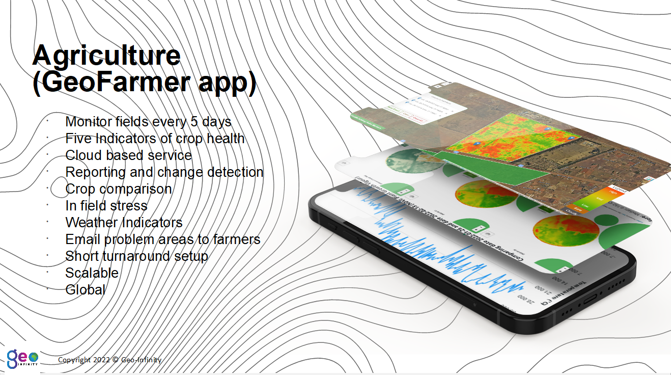
GeoFarmer®
Revolutionize Agriculture with GeoFarmer®: Cultivating Success through Precision Farming
Introducing GeoFarmer®: Your Path to Precision Farming Excellence
At Geo-Infinity, we are proud to partner with GeoTerraImage to bring you GeoFarmer®, the groundbreaking precision farming application that is transforming the agricultural landscape. With a powerful combination of remote sensing-based indicators and cutting-edge weather data, GeoFarmer® empowers farmers like never before, ensuring optimal crop management and unparalleled success.
Unleash the Power of GeoFarmer®:
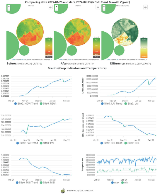
- Maximizing Crop Yield: GeoFarmer® equips farmers with an arsenal of remote sensing-based indicators, providing invaluable insights into crop health, vegetation vigor, and nutrient levels. By harnessing this data, farmers can optimize irrigation, fertilizer application, and pest management strategies, ultimately leading to maximized crop yield.
- Prescriptive Analytics: GeoFarmer®'s advanced analytics engine goes beyond just monitoring crop progress. It analyzes the data collected from satellite imagery, weather forecasts, and historical trends to show where in the field your crops could have potential problems – pin point the locations and send to your farm manager to check in field.
- Real-Time Monitoring: With GeoFarmer®, stay connected to your fields like never before. The application offers real-time monitoring capabilities, enabling you to track your crops' growth, health, and environmental conditions from anywhere, at any time. Stay ahead of potential risks, detect anomalies early, and take proactive measures to safeguard your harvest.
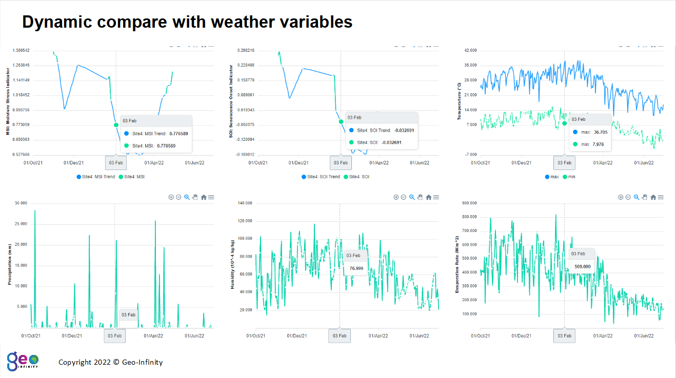
- Weather Intelligence: GeoFarmer® integrates comprehensive weather data to provide you with a holistic view of the growing conditions. From precipitation patterns to temperature fluctuations, access vital weather information that allows you to make informed choices and mitigate climate-related risks effectively.
- Seamless Integration: GeoFarmer® seamlessly integrates with your existing farming systems and equipment, ensuring a smooth transition into precision farming. With user-friendly interfaces and intuitive functionalities, the application is designed to enhance your productivity without disrupting your current operations.
Unlock the Potential of GeoFarmer® Today:
Join the ranks of forward-thinking farmers who are revolutionizing the way they cultivate. With GeoFarmer®, you harness the power of advanced technology, data-driven insights, and precision farming techniques to elevate your agricultural practices to new heights.
Experience the Future of Farming with GeoFarmer® – Discover a world where each acre flourishes, every decision is rooted in knowledge, and your harvest becomes a true testament to your expertise. Get started on your journey to agricultural excellence today.
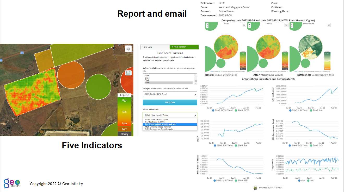
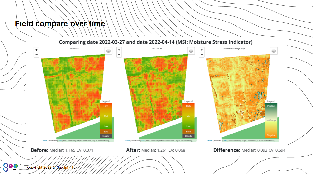
GEOFarmer®© (Crop condition indicators)